Wednesday, 13 May 2020

Musical Heritage in Mississippi


The state of Mississippi is the birthplace of the blues and has influenced many other genres of music from jazz to country, rock’n’roll to gospel. Many legendary musicians have a history in Mississippi including Elvis Presley, Robert Johnson, Muddy Waters, BB King, Howlin’ Wolf, Charley Patton, Son House and WC Handy. The Mississippi Blues Trail, established in 2003, places markers throughout Mississippi to honour the places and people that gave birth to the blues.

Music Heritage in Clarksdale

Visit the Delta Blues Museum located in Clarksdale, home of the famous Robert Johnson crossroads and the Delta region known as land of the Delta blues. Legendary Delta blues artists like John Lee Hooker, Muddy Waters, Ike Turner, Son House, Sam Cooke, Jackie Brenston, Junior Parker and WC Handy were born and raised in or around Clarksdale and travelling musicians like Robert Johnson, Howlin’ Wolf and Charley Patton are also associated with the city. Today, the Delta blues history is preserved for visitors at the Delta Blues Museum where the exhibitions and events tell the story of the blues in the states oldest music museum. The Delta Blues Museum Stage serves local festivals such as the Juke Joint Festival in April and the Sunflower River BluesFestival in August.

As grittily as they come and drenched in Delta history is the Riverside Hotel, Clarksdale, just one of many historical blues sites and the fourth marker placed on the Mississippi Blues Trail which will eventually be composed of over 120 markers. The Riverside Hotel on Sunflower Avenue, Clarksdale originally opened in 1944, but before this it was the GT Thomas Hospital where in 1937 Bessie Smith died after a car accident on Highway 61. This room is now known as Room No.2 and is available to rent. Frank “Rat” Ratcliff, only 4 when his mother converted this building into a hotel, is the current proprietor and has many colourful and wonderful stories of the blues. Ike Turner lived in Room No.7 for a number of years and wrote Rocket 88 here. Room no. 6 is where John Lee Hooker used to stay and was often seen practising on the front steps. Other great bluesmen have also stayed here including Sonny Boy Williamson II, Howlin’ Wolf, Muddy Waters, Robert Nighthawk and Sam Cook, as well as other famous guests like John F Kennedy Jr.

Music Heritage in Cleveland

Visit the Delta State University Archives in Cleveland, Mississippi which include occasional Smithsonian exhibits, historical displays and changing exhibits on the Delta.  Here you can also take the Historic Blues Driving Tour, a self guided tour of sites important to the blues music. 

The Dockery Plantation, an old cotton plantation on the Sunflower River, accounts for the region’s importance in the blues culture. It was the base for a group of musicians including blues pioneer Charley Patton, Son House, Robert Johnson and Howlin’ Wolf and is widely regarded at the place where the Delta blues was born. To highlight the important contribution to the Delta blues history, the plantation has been allocated a blues marker on the MS Blues Trail. 

Music Heritage in Greenwood

The Greenwood Blues Heritage Museum & Gallery is a showplace dedicated to the life, career and afterlife of Robert Johnson “King of the Delta blues singers”, and to other central Delta blues music artists featuring an exhibition of photographs and memorabilia. The museum raises awareness and shows appreciation of Blues music in the Delta. Robert Johnson’s tombstone in Greenwood, Mississippi marks one of three reputed burial sites to one of music’s greatest artists and is also marked with a MS Blues Trail marker.

Just minutes away from Greenwood is Indianola, the birthplace of international superstar and blues legend BB King. A visit to the Delta is not complete without stopping to check out the BB King Museum and Delta Interpretive Centre – a state-of-the-art facility dedicated to the life and music of its namesake as well as the land that inspired his sound.

Music Heritage in Oxford

Tour the Ole Miss Blues Archive in Oxford, Mississippi. The blues Archive has over 60,000 sound recordings, over 20,000 photographs, more than 1,000 videos and over 6,000 books & newsletters and numerous manuscripts, making it one of the largest collections of blues memorabilia in the world. Should you happen to be on Oxford's historic town square on a Thursday night, be sure to check out Thacker Mountain Radio, a broadcast of literary readings and an eclectic mix of musical performances.

Music Heritage in Tupelo

At the birthplace of Elvis Presley in Tupelo, Mississippi view a statue of Elvis as a boy, tour the humble two-room shotgun house built by his father where the King of Rock and Roll was born and raised, visit the memorial chapel where Elvis discovered his first musical influences and the Elvis Presley Museum showcasing how his roots influenced his future. The self guided tours take you around some of the most significant locations in Elvis’ life in Tupelo. The “Walk of Life” surrounds the house with path following dated granite blocks denoting each year of Elvis’ life from 1935 to 1977. The annual Elvis Presley festival is held here every June and Tupelo is also featured on the Mississippi Blues Trail. Then continue your Elvis journey to Graceland in Memphis.

Music Heritage in Leland

Visit the Highway 61 Blues Museum in Leland Mississippi and experience the history of the Delta Blues with exhibits, signed artefacts and memorabilia 

throughout the museum that honour the Mid-Mississippi Delta Bluesmen. The Leland Blues Project has commissioned a number of murals to be painted on the walls of downtown buildings and several of these murals are completed with more being planned. The Leland Blues Project participates in many blues events in the area like The Block Parties, Blues Festival and Fall Arts Fair which all feature local blues greats.

•culled from www.deep-south-usa.com


Tuesday, 12 May 2020

What Is the Capital of Washington?

The capital city of Washington is Olympia.
Washington State Capitol building in Olympia, Washington.

The state of Washington is located in the Pacific Northwest region of the United States. Olympia is the state capital of Washington, and also serves as the administrative seat of Thurston County. The city is located at an altitude of 95 feet above sea level and covers an area estimated at 19.68 square miles, 91% of which is land, and 9% is covered by water. The population of Olympia is estimated to be 50,302 as at 2015, and has a population density of 2,685 people per square mile. The current mayor of Olympia is Cheryl Selby.

History of Olympia

Olympia has been inhabited by the Lushootseed people for several thousands of years. The native community included the Puyallup, Squaxin, Chehalis, Nisqually, Duwamish, and the Suquamish tribes. The first record of Europe settlers occurred in 1792, when the British Vancouver Expedition, led by Peter Puget, arrived in the area. Levi Smith and Edmund Sylvester both claimed the land that is now constitutes Olympia in 1846. By 1851, the US Congress sanctioned the creation of Customs District in Washington Territory, and the population grew over the years when Oregon Trail immigrants settled in the area. The name Olympia was given to the town in 1850, when Colonel Isaac N. Ebey, a resident, suggested the name because the Olympic Mountains in the northwest were visible from the town. In 1896, the Olympia Brewing Company was established in Olympia, and it brewed the Olympia Beer brand until 2003. In 1949, a major Earthquake hit Olympia and destroyed most of the city's historic buildings. The city was hit again by earthquakes in 1965 and 2001.

Demographics

The population of Olympia is predominantly Caucasian (86%), and also includes Asians (6.05%), mixed race (3.8%), African Americans (1.4%), Native Americans (1.06%), and native Hawaiians (0.37%). 87% of Olympia's citizens speak English, and 5% speak Spanish. Literacy levels in Olympia are high, standing at 92% of adults aged above 25 years. About 41% of people above 25 years hold a bachelor's degree. About 46% of the men and 43% of women are married, while 40% of men and 30% of the women have never been married. The median age of the people living in Olympia is about 38 years.

Economic Activities

The main economic activity of Olympia has been manufacturing, especially the manufacturing of plastics and industrial supplies. Recently, tourism has increased due to Olympia’s broad range of conservation areas and public parks. Tourism has increased by 27% between 1998 and 2003, and has been increasing ever since. Commercial shipping at the Port of Olympia is also a substantial contributor to the economy of this city.

Weather and Climate

The area surrounding Olympia experiences warm summer, Mediterranean climate. Olympia's dry and warm season begins at the end of June and ends in mid-September, with temperatures averaging 70°F. The cold season starts in mid-November and ends at the end of February, and is wet and chilly with temperatures averaging 43°F.

•By Joseph Kiprop

•culled from www.worldatlas.com

The 10 Biggest Cities In Washington

Seattle is the biggest city in the US state of Washington in terms of both population and land area.
The skyline of Seattle, Washington.

The State of Washington

The US state of Washington is located in the country’s Pacific Northwest region. With an area of 184,827 square km, it is 18th most extensive state in the US. The state has a population 7,405,743, which ranks as the 13th most populous in the nation. Washington is subdivided into 39 counties and contains 281 incorporated municipalities, which include both cities and towns.

The Five Biggest Cities in Washington

1. Seattle

Seattle is the largest city in the state of Washington. It is a seaport city with a population of 608,660, which also makes it the most populous city in North America’s Pacific Northwest region and one of the fastest growing cities in the US. Seattle is situated on an isthmus between Lake Washington and Puget Sound. Logging was the first major industry in the city, and Seattle is now the fourth largest container port in North America. Since the 1980s, the city has become a hub of information technology and biotechnology industries. The founder of Microsoft, Bill Gates, is from Seattle, and e-commerce company Amazon was founded in the city. Seattle also has a rich culture, and is known for its musical history. It has a thriving jazz and rock music industry. Rock and Roll Hall of Fame guitarist Jimi Hendrix was born in Seattle.

2. Spokane

With a population of 208,916, Spokane is Washington’s second most populous city. It is the county seat of Spokane County and is located along the Spokane River. It is nicknamed the "Lilac City" and is the birthplace of Father's Day. Spokane's economy was initially dependent on natural resources, as mining, agriculture, and logging helped the city grow. Today, Spokane has a diversified economy, and is becoming increasingly service-oriented. The city’s location near dozens of lakes and rivers allows inhabitants to enjoy numerous outdoor sports and recreational activities. The city is also served by Spokane International Airport. 

3. Tacoma

Tacoma has a population of 198,397, making it Washington’s third largest city. It is an urban port city that serves as the county seat of Pierce County. It is located on the Puget Sound, about 51 km southwest of Seattle. Tacoma is a hub of business in the South Sound region.

4. Vancouver

Not to be confused with the Canadian city of the same name, Vancouver, Washington is located on the north bank of the Columbia River. It had a population of 161,791 in 2010, ranking as the fourth biggest city in the state, and serves as the county seat of Clark County. It was founded in 1825 as a fur-trading outpost, and later incorporated in 1857. Located near the Washington-Portland state border, Vancouver is considered a suburb of Portland, Oregon. Given that the two states have different levels of income, property and sales taxes, Vancouver's proximity to the state border means its economy benefits from the principle of border economics.

5. Bellevue

Bellevue is Washington’s fifth most populous city, with a population of 122,363. The city is located in King County, within its Eastside region. The downtown area of Bellevue is a thriving business center that features approximately 1,300 businesses and 45,000 employees. In recent years, Bellevue has been ranked as one of the best places to live and work in the US by various surveys, including CNN Business and USA Today.

The Capital of Washington

Interestingly, the state capital of Washington is not included on the list of the state’s 10 most populous cities. Olympia, the state capital, is the 22nd most populous city in the state, with a population of only 46,478. Olympia serves as the county seat of Thurston County.

The 10 Biggest Cities in Washington by Population

Rank Name County Population (2010 Census) Land Area

1 Seattle King 608,660217.1 km2
2 Spokane Spokane 208,916178.0 km2
3 Tacoma Pierce 198,397128.8 km2
4 Vancouver Clark 161,791121.2 km2
5 Bellevue King 122,36386.7 km2
6 Everett Snohomish 103,01985.8 km2
7 Kent King 92,41187.4 km2
8 Yakima Yakima 91,06771.6 km2
9 Renton King 90,92760.5 km2
10 Spokane Valley Spokane 89,75597.7 km2

By Oishimaya Sen Nag

Culled from www.worldatlas.com

The 10 Biggest Cities In West Virginia

Charleston is the US state of West Virginia's largest city by population.
Charleston, the largest city in West Virginia.

The US state of West Virginia is located in the country’s southern region. It occupies 62,755 square km, which ranks as the 41st largest US state by area. The state has a population of around 1,805,832 people, making it the 38th most populous in the country. West Virginia is subdivided into 55 counties, and Logan County contains the most census-designated places (CDPs) in the state, with a total of 22 CDPs.

The Five Most Populated Cities in West Virginia

1. Charleston

Charleston is the capital and most populous city of West Virginia. The 2010 Census estimated the city’s population at 51,400. Charleston is located at the confluence of two rivers, the Kanawha and the Elk. It is the hub of commerce, industry, and serves as the county seat of Kanawha County. Charleston is also an important educational center in West Virginia, as it is home to the University of Charleston, as well as other state and private university campuses.

2. Huntington

With a population of 49,138, Huntington is West Virginia’s second largest city. It is the county seat of Cabell County and is located on the Ohio River, near the mouth of the Guyandotte River. The city also extends into Wayne County. Huntington is the country’s second busiest inland port, and the city has a diversified economy. Extensive natural resources near the city have led to the development of a thriving economy.

3. Parkersburg

The third most populous city in West Virginia is Parkersburg, which had a population of 31,492 in 2010. It serves as the county seat of Wood County and is the largest city in the Parkersburg-Marietta-Vienna metropolitan area. Parkersburg spans an area of 31.99 square km and is located at the confluence of the Ohio and Little Kanawha Rivers. The latter divides the city into a northern and southern side. The Kanawha River’s tributary, Worthington Creek, passes through the eastern part of Parkersburg.

4. Morgantown

The fourth biggest city in West Virginia is Morgantown, which has a population of 29,660. The city serves as the county seat of Monongalia County and is located on the banks of the Monongahela River. The Morgantown Personal Rapid Transit and the West Virginia University are located in the city.

5. Wheeling

Wheeling is the fifth largest city in West Virginia, with a population of 28,486. The city covers parts of both Ohio and Marshall counties, and serves as the county seat of Ohio County. Wheeling is located at the foothills of the Appalachian Mountains, along the Ohio River. The major industries within the city include education, healthcare, tourism, energy, and legal services.

The Smallest CDP in West Virginia

With a population of only 9, Bowden is West Virginia’s least populous census-designated place (CDP). It occupies an area of only 0.32 square km in Randolph County, which also makes it the smallest CDP in the state by area.

The 10 Biggest Cities in West Virginia by Population

Rank City Population (2010 Census) County

1 Charleston 51,400 Kanawha
2 Huntington 49,138 Cabell
3 Parkersburg 31,492 Wood
4 Morgantown 29,660 Monongalia
5 Wheeling 28,486 Ohio
6 Weirton 19,746 Hancock
7 Fairmont 18,704 Marion
8 Beckley 17,614 Raleigh
9 Martinsburg 17,227 Berkeley
10 Clarksburg 16,578 Harrison

•By Oishimaya Sen Nag

•culled from www.worldatlas.com

Population Of West Virginia

Only 1.1% of West Virginia's population is foreign-born, and only 2.7% of the residents do not speak English at home.
A Saturday afternoon street scene. Welch, McDowell County, West Virginia in 1946.

Vital Statistics Of The Population Of West Virginia

The US state of West Virginia (WV) has a population of 1,844,128. The population has grown somewhat over the last few years and is mainly as a result of immigration. People moving into the state mainly come from other areas in the US, only 1.1% of the population here is foreign-born. This state is the only one in the country where the number of deaths exceeds the number of births; over a 3 year period, 3,000 more deaths than births occurred; this is called a net mortality society. In terms of health, WV ranks last or second to last. It has some of the highest rates in the country for cancer, diabetes, disabilities, low birth weights, teeth loss, and deaths due to drugs. Approximately 17.3% of its residents have obtained a bachelor's degree, the lowest percentage in the country. Many of these statistics are related to the extremely high rates of poverty within the state. Low educational attainment and poor health go hand in hand with low socioeconomic statuses.

Racial Composition Of The Population Of West Virginia

The racial demographics of the state are as follows: White (93.9%), Black (3.4%), Asian (.7%), Native American (.2%), Other Races (.3%), and Two or More Races (1.5%). The majority of residents are of European descent. German ancestry ranks highest (18.9%); followed by Irish (15.1%); American, an ethnic identity that moved away from hyphenating and generally dates back to colonial-era genealogy (12.9%); English (11.8%); and Italian (4.7%).

Religion Of The People Of West Virginia

Statistics of religious beliefs within this state are difficult to accurately calculate due to a large number of independent, non-affiliated churches. This occurrence is common throughout Appalachian communities and may increase the percentage of irreligious or unaffiliated. Christianity is the most widely practiced religion, however, with 77% of the population reporting this as their beliefs. Of the various Christian denominations, the vast majority are Evangelicals, followed by Baptist, Methodist, Catholic, Presbyterian, and Lutheran. Approximately 3% of the population practice other religions such as Islam, Judaism, and Mormonism. One-fifth of those questioned responded as unaffiliated or refused to answer. These numbers make WV the 7th most religious state in the nation.

Economy Of West Virginia

This state once relied mainly on the coal mining and lumber industries. Modernization of extraction methods, however, have resulted in decreased job opportunities for residents in many areas, particularly the south. Although, energy continues to play a big role in the economy. WV is one of the leading exporters of coal mine production, interstate electricity, and natural gas. It is responsible for 15% of national fossil fuel energy use. Other big industries within the state also provide jobs and revenue. Chemical production, for example, provides 20% of all manufacturing jobs in the state and 40% of all manufacturing economic output. Biotech industries such as Dow, DuPont, and PPG, are another big economic contributor to the region. Over 45,000 residents work in advanced technology industries, and the state is 34th in the nation for received federal research and development funds. With the state’s wealth of natural resources, protected parks, music festivals, and historic places, tourism is also important to the economy. This industry provides approximately 44,000 jobs to residents. Unfortunately, while the salary for income earners in the lowest brackets increased by 19% across the country, it decreased by 3% in WV. In 2013, the state lost nearly 6,000 industry specific jobs; although in general, jobs grew by 1,000 positions.

Population Of West Virginia

Rank Racial composition% Of Population (2010)

1 White 93.9%
2 Black 3.4%
3 Asian 0.7%
4 Native 0.2%
5 Other race 0.3%
6 Two or more races 1.5%

•By Amber Pariona

•culled from www.worldatlas.com


What Is the Capital of West Virginia?

The capital city of West Virginia is Charleston.
The State Capitol Building in Charleston, West Virginia.

The capital of the US state of West Virginia (WV) is Charleston. It is the most populated city in the state, with a population size of approximately 51,400 and a metropolitan population size of 224,743. This makes Charleston the smallest capital city in the country that is the most populated city in the state.

Charleston is home to a number of cultural events including free outdoor summer concerts, the Spartan Race, which is one of the world's most difficult obstacle races, minor-league baseball and basketball teams, and Mountain Stage, a 2-hour, live music show broadcast around the world via National Public Radio. The city serves as the cultural, economic, and government center for West Virginia.

Geography of Charleston

Charleston sits within a valley on the western edge of the Appalachian mountains, which is considered one of the country's oldest mountain ranges. The city is located in Kanawha County, near the point at which the Elk and Kanawha rivers meet. This area makes up part of the Western Allegheny Plateau ecoregion, a temperate broadleaf and mixed forest biome. This location places Charleston between 2 climates: the humid subtropical climate and the humid continental climate. These climates mean that the city experiences four distinct seasons every year, with higher-than-average temperatures compared to other cities in the state.

History of Charleston

This city was established in 1787, when the area was still part of the state of Virginia. It first served as a permanent military settlement known as Fort Lee until 1793, when the Virginia General Assembly granted it official city status. At the time, it had population of 35.

Charleston began to grow economically after the discovery and development of salt brines along the Kanawha river in 1806. Salt mine operations led to the discovery of natural gas in 1815. This discovery, in turn, led to the discovery of coal deposits in 1817, which has been one of the primary economic contributors to the area for the last 200 years.

During the American Civil War, the state of Virginia joined the Confederate cause and seceded from the Union. Charleston, however, was occupied by Union forces. By 1863, the western region of Virginia became the state of West Virginia, and Charleston was named the capital. Its manufacturing industry continued to grow and progress in large part because of the rich natural resources of the area. Some of the most important industries of the time included timber, coal, natural gas, glass, chemicals, and steel.

Demographics of Charleston

The population of Charleston is approximately 51,400. This population size means the residents live with a population density of just over 1,630 individuals and 831.4 housing units per square mile.

The racial makeup of these individuals is as follows: White (78.4%), African-American (15.5%), Asian (2.3%), and Native American (0.2%). Of these races, about 1.4% of the population identify to be of Latino or Hispanic descent. Nearly half (46.3%) of all households in Charleston are made up of non-family residents, which suggests that many people live with friends or roommates. The average household size is 2.11 and slightly more than one-third (35.6%) of all households consist of married couples.

•By Amber Pariona

•culled from www.worldatlas.com

Monday, 11 May 2020

What Is the Capital of Virginia?

The capital city of Virginia is Richmond.
Richmond, the capital city of Virginia. © Shutterstock

The capital of the state of Virginia is Richmond, which was founded in 1737 by "The Father of Richmond" also known as William Byrd II. Richmond is the third city to be the state capital of the Virginia Commonwealth; it was preceded by Jamestown and Williamsburg. Like many cities in Virginia, Richmond is a free city, meaning it is not politically part of any county, even though it is located within a county. Richmond gained its status as a free city in 1871; it became the capital of Virginia in 1780. The city is located at an altitude of 167 feet above sea level, and it has an estimated population of 233,170 and covers an area of 62.5 square miles in size.

History of Richmond

In April 1607, the first English speakers settled in Jamestown in Virginia who were explorers led by Captain Christopher Newport and later moved up the James River to a new settlement in the area which is the present day Richmond.In 1737, William Byrd II requested Major William Mayo to design the town grid, and he named the city Richmond after the Richmond town in England near London. The reason was that the view of James River was similar to the view of River Thames on Richmond Hill in the UK. Byrd had spent time in England when he was a youth. The settlement that was laid down was later incorporated as a town in 1742.

Demography

The population in Richmond is predominantly African American who constitutes about 44% of the population, Caucasians form 44% of the population while those reporting a mixed origin form 3.46%, and Asians make up 2.25% of the population. The population in Richmond is relatively young with the median age being approximately 33 years, and 55% of the males and 49% of the females in the area have never been married.

Cuisine

The racial diversity is reflected in the cuisine in Richmond. The food is a mix of African-American, Asian and South American cuisines. Richmond and other parts of Virginia have its own tradition, which includes Smithfield ham, which is called Virginian ham. It is a unique country ham which receives protection from the law of the state. Barbecue Richmond and the while of Virginia is the same as the North Carolina’s barbecue. The barbecue is primarily made from pork and vinegar based sauce. There is the famous marble cake, the shoofly pie, fried peaches, which is simmered in butter with brown sugar and served with vanilla ice. Richmond was voted one of the places to travel for food by the National Geographic Traveler in 2016. The city has an array of spots to have a bite that ranges from casual for the usual fast food such as cookout, Chick A Fil, Fire Gus among others. The Italian specialties are served at Sub Rosa, Mama Zu, and Edo Squid. Sub Rosa also serves French pastry as well.

Economy

The population in Metro Richmond stands at 1,272,600, and the major industries include technology, Bio-sciences, and financial services. The median household income is $62,898, and the gross GDP is $77.8 billion, and the unemployment rate is 3.9%. According to Forbes, Richmond has ranked the 49th best places for business and careers. The economy of Richmond is driven by government, finance, and Law including banking, and legal firms in the downtown region. Richmond is home to the great Turning Basin for boats, the only triple crossing rail lines in the world and the intersection of two main interstates. Richmond is a strong manufacturing hub boasting of having Philip Morris, the tobacco manufacturing firm. There is also an influx of semiconductor firms in the area that has boosted the economy of Richmond.

•By Joseph Kiprop

•culled from www.worldatlas.com


Sunday, 10 May 2020

The Biggest Cities in Virginia

The largest city in Virginia by population is Virginia Beach, followed by Norfolk and Chesapeake.
The boardwalk at Virginia Beach. © Shutterstock

The state of the Commonwealth of Virginia is located between the Appalachian Mountains and the Atlantic coast. The State is ranked 35th in land area with a total of 42,774.2 square miles. The total population of Virginia as estimated in 2017 is 8.4 million. Some of the nicknames that people refer to Virginia are, “Old Dominion,” “Mother of Presidents, and Mother of Statesmen.” There are 95 counties and 38 independent cities. The biggest cities in Virginia include the following:

The Biggest Cities In Virginia

Virginia Beach

Virginia Beach is the largest city in Virginia. It is located on the southeastern coast of the state, where both Chesapeake Bay and the Atlantic Ocean meet. It has an area of 497 square miles with an elevation of about 12 feet above the sea level. The total population of the city is estimated to be 452,745. Virginia Beach has beaches covering miles with numerous restaurants, motels, and hotels on its oceanfront. The city hosts sporting events each year such as North American Sand Soccer Championships and East Coast Surfing Championships. Virginia Beach is well known for being a resort city.

Norfolk

Norfolk is a city located in southeastern Virginia at the junction of Chesapeake Bay and the Elizabeth River. The total population of the area is estimated to be 245,782, and the total area of Norfolk is 96 square miles.

Chesapeake

Just next to Norfolk lies Chesapeake. Its population is estimated to be 222,209 and it shares a border with North Carolina. It has an area of 351 square miles. The Great Dismal Swamp is found at Chesapeake. The median age of the residents of Chesapeake is 36.7 years, and their median income is $69,978.

Richmond

Richmond has a population of 210,309, and it is the state capital of Virginia. It is located in Piedmont region of Virginia and has an area of 60 square miles. This is the city in which Patrick Henry a famously declared “Give Me Liberty or Give Me Death” during the revolutionary war.

Other Big Cities In Virginia

Other big cities in the Commonwealth of Virginia include Newport News (180,000), Alexandria (147,391), Hampton (146,437), Portsmouth (96,470), Roanoke (94,911), and Lynchburg (65,269). There many towns in Virginia which are as large as cities, but they have not been incorporated as cities and are located within the parent county. The independent cities of Virginia were classified in 1871 by the General Assembly of Virginia, and they are categorized as first-class cities and second-class cities. The first class cities were categorized as those having a population size of more than 10,000 inhabitants, while those with less than 10,000 were categorized as second-class cities.

The Biggest Cities in Virginia

Rank City Population
 
1 Virginia Beach 447,021
2 Norfolk 245,782
3 Chesapeake 222,209
4 Richmond 210,309
5 Newport News 180,726
6 Alexandria 147,391
7 Hampton 146,437
8 Portsmouth 96,470
9 Roanoke 94,911
10 Lynchburg 65,269

•Benjamin Elisha Sawe

•culled from www.worldatlas.com


What Is the Capital of Vermont?

The capital city of Vermont is Montpelier.

Montpelier, the capital of Vermont.

Vermont is an American state in the New England region of the North-Eastern part of the United States. Its capital city is Montpelier and it has the designation of being the least populous capital in America. The name Montpelier originated from the French city Montpellier given by Colonel Jacob Davis when he arrived in the area from Charlton, Massachusetts. Montpelier has a population of 7,855 people, although during the day the population increases to 21,000 brought about by employment within the city. It is also home to the famous gold leaf dome which is the Vermont state house also known as Capitol. The Winooski River is the major water mass flowing on the western side of the city. Montpelier is graced by Vermont College of Fine Arts and New England Culinary Institute as their major institutions of higher education.

History

Settlement began as early as 1787, and within four years the population had increased to 117 people. In the early 1800’s it was incorporated as a village and in 1895 it was declared a city. The central Vermont railway was opened in 1849 which resulted to Montpelier becoming a manufacturing hub. The falls from the Winooski River was used to provide power for the mills, and finally, the iron foundry was introduced. In 1884 the town had its first municipal water pumped and electricity generated to supply their streetlights.

Economy

The current per capita income of Montpelier is $32,108 with 9.8% of the population living below the poverty line. The main contributors of the city’s economy include the government, insurance, tourism, and higher education sectors. Since 1805, the primary contributors to the Montpelier GDP have been generated from the government, however in the 19th century, life and fire insurance were introduced. This created companies like The National Life Group which is headquartered in the city. The city is also known for its worldwide production of the granite memorial and is home to Ben and Jerry’s ice cream. There is also the presence of for-profit schools and colleges like New England Culinary Institute and Vermont College of fine arts. Montpelier is the geographic center of Vermont State making it easily accessible and a hub for a business like its famous maple syrup.

Culture

In the early years, Montpelier was first occupied by the Abenaki tribe known as the Sokoki, then later by the French, and finally, the Americans settled in the present day city location. Currently, it has diverse occupants from different cultures. Its unique blend of the racial composition is comprised of Caucasians, African Americans, Native Americans, Asians, Hispanic, Latinos, Pacific Islanders among other races all these made possible by its thriving industry sector and demand for employment. It has a robust arts community with different events taking place and has many galleries and studios.  Its rich history is preserved in the Vermont History Museum and The Kellogg-Hubbard Library. The two major theatres are Lost Nation Theatre and Montpelier Theatre Guild. The city also prides of one major event that takes place annually called the Valentine Phantom which occurs every February 14th and entails covering storefronts and public buildings with red hearts, a tradition which began in the 1990s. Montpelier also has many nature parks including Hubbard Park, the North Branch River Park, and the Mill Pond Park.

•By Joseph Kiprop

•culled from www.worldatlas.com

The Biggest Cities In Vermont

Burlington is the most populous city in the US state of Vermont.
Burlington, the largest city in Vermont.

State of Vermont

The US state of Vermont is located in the country's New England region. It is the second least populous state in the US, with an estimated population of 623,657 in 2017. Covering an area of 24,923 square km, Vermont is also the county’s sixth smallest state by area. Vermont is subdivided into 14 counties and 255 municipalities. However, only 9 of these municipalities are incorporated as cities. Vermont is the largest producer of maple syrup in the country. In 2016, it was ranked as the safest US state.

The Five Most Populated Cities in Vermont

1. Burlington

Burlington is the biggest city in Vermont, with a population of 42,417 in 2010. The city serves as the seat of Chittenden County and is located near the US-Canada international border. Burlington is a regional college town, and home to the University of Vermont and Champlain College. The state’s biggest hospital, the University of Vermont Medical Center (UVM), is also located within the city. In 2015, Burlington became the first city in the US to operate completely on renewable energy.

2. South Burlington

Located in Chittenden County, South Burlington is the second most populated city in Vermont, with a population of 17,904 in 2010. The state’s largest mall, the University Mall, and its biggest airport, Burlington International Airport, are both located in the city. The headquarters of Ben & Jerry's, the American company famous for its ice cream, is also located in South Burlington.

3. Rutland

Rutland is Vermont’s third most populous city. It has a population of 16,495 and serves as the county seat of Rutland County. Rutland is located approximately 20 miles east of the state of New York and 65 miles north of Massachusetts. The downtown area of Rutland is a designated historic district. In fact, 108 buildings in the downtown are included in the National Register of Historic Places. 

4. Barre

The fourth most populated city of Vermont, Barre, has a population of only 9,052. The area that is now Barre was first settled by Europeans in 1788. It was originally called Wildersburgh, but later renamed Barre after Irish soldier and politician Isaac Barré. The city is located near vast deposits of granite, which helped grow its economy. In fact, the city proclaims itself as the "Granite Center of the World." The city is largely surrounded by a town named Barre, but the city and town of the same name are distinct municipalities.

5. Montpelier

Montpelier is the state capital of Vermont. With a population of only 7,855, it is the state’s fifth biggest city. Named after the city of Montpellier in southern France, Montpelier, Vermont is the country’s least populated state capital. Although the population of Montpelier is small, its daytime population is much higher, increasing to approximately 21,000. This temporary population boost is composed of employees who arrive from the suburbs or nearby towns to work in the city.

Composition of Vermont’s Population

The vast majority of Vermont's population (94.3%) identify as white (not of Latino or Hispanic origin), which is the second highest proportion of any state other than Maine. Vermont has one of the highest divorce rates in the country, and the second highest LGBT population density, after the District of Columbia.

The Biggest Cities in Vermont by Population

Rank City County Population (2010)

1 Burlington Chittenden 42,417
2 South Burlington Chittenden 17,904
3 Rutland Rutland 16,495
4 Barre Washington 9,052
5 Montpelier Washington 7,855
6 Winooski Chittenden 7,267
7 St. Albans Franklin 6,918
8 Newport Orleans 4,589
9 Vergennes Addison 2,588

By Oishimaya Sen Nag

Culled from www.worldatlas.com

Friday, 8 May 2020

What Is the Capital of Utah?

The capital city of Utah is Salt Lake City.
The skyline of Salt Lake City, Utah.

The state of Utah is located in the western part of the United States, and was the 45th state to join the country in 1896. The state is the 31stmost populous and the 13th largest by area in the country. Utah has a population of about 3 million people and its state capital is Salt Lake City, also known as SLC, or simply Salt Lake.

History

The earliest inhabitants of Salt Lake City were the Shoshone, Ute, and Paiute tribes, and later the Mormons. The land was public domain according to the United States government, and records show that Jim Bridger was the first US explorer in Salt Lake City in 1825. In 1847, a group of permanent settlers arrived in the unoccupied area of Salt Lake City. This group, the Latter-day Saints, was seeking a secluded area to practice their religion away from persecution and violence. Led by Brigham Young, it is believed that they founded the city. After extensive cultivation and irrigation of the valley, the Mormons were able to fend for themselves, and began to grow the city and its economy. Due to its proximity to the lake, the area got the name "Great Salt Lake City." The word "Great" was later dropped by the Territorial Legislature. Through mining and construction, Salt Lake City prospered in the years that followed.

Geography

Salt Lake City covers an area of 110.4 square miles and has an elevation th 4,327 feet above sea level. The city is located on the northwest corner of the state, and has Great Salt Lake in the northwest, and the Wasatch and Oquirrh mountain ranges in the east.

Demographics

The city has an estimated population of 190,884 as of 2016. The racial composition is as follows: Caucasian (75.1%), Non-Hispanic (65.7%), African-American (2.6%), Hispanic or Latino (22.3%), and Asian (4.4%). Despite its history, less than 50% of its population belongs to The Church of Jesus Christ of Latter-day Saints.

Law and Government

Salt Lake City has had a non-partisan mayor council form of government for over 40 years. Like most states in the US, the mayor is elected by citizens, as well councillors, usually for a four-year term. The present mayor is Jackie Biskupski. Salt Lake City citizens have encouraged a heated debate on separation of government from the church, because the government has been accused of giving preferential treatment to the members of the Latter-day Saints Church.

Culture

With its rich history, Salt Lake City is home to many museums and most importantly, a church history museum, mostly dedicated to the Latter-day Saints Church. It stands next to the temple square and has materials, artifacts, and documents of the Latter-day Saints Church. The city is also known for its vibrant social festival culture. Many festivities take place in the area which celebrate the area which celebrate the city’s diverse communities. Most of these festivals have existed for more than a decade, and bring the people of Salt Lake City together for cultural growth.

•By Joseph Kiprop

•culled from www.worldatlas.com

The 10 Biggest Cities In Utah

Salt Lake City, the largest city in Utah.

Salt Lake City is Utah's biggest city.

Utah is a US state located in the Western regionof the country. With a population of around 3,101,833 individuals, it is the country’s 31st most populous state. It has an area of 219,887 square km that makes it the 13th most extensive US state. Utah has 243 incorporated municipalities. A municipality in Utah is designated as a town if it has a population of below 1,000 people and a city if its population is 1000 and over. 88.2% of the state’s population lives in its municipalities. The Wasatch Front counties of the state have the highest population concentration. These counties include Davis, Salt Lake, Utah, and Weber.

The Five Most Populated Cities In Utah

1. Salt Lake City

Salt Lake City is Utah’s capital and most populous city. It is located in Salt Lake County and had a population of 186,440 in 2010. The world headquarters of the LDS Church is located in this city. It was established in 1847 by Brigham Young and other adherents of the LSD Church (the Pioneers). They built the city as a safe refuge to escape religious persecution in the mid-western US. The Great Salt Lake is located nearby. Today, the Salt Lake City is a major tourist spot in the US. It offers many outdoor recreation activities to its tourists. The 2002 Winter Olympics was hosted here. The city is also the national hub of industrial banking.

2. West Valley City

With a population of 129,480, West Valley City is Utah’s second most populous city. It is a suburb of Salt Lake City and is located in the Salt Lake Valley’s northwest side. The Jordan River borders the city to the east while the Oquirrh Mountains forms the western border. The West Valley City was established in 1980. The USANA Amphitheatre and the Maverik Center are located here.

3. Provo

Provo, the third most populous city in Utah, is home to 112,488 individuals. It is located along the Wasatch Front to the south of Salt Lake City. Provo serves as the Utah County’s county seat. The Brigham Young University is located in Provo. The city is an important area for technology development in the state. It was entitled among the "Best Small And Medium-Size Cities For Jobs” by the Forbes in 2015.

5. West Jordan

West Jordan, the fourth biggest city in Utah, had a population of 103,712 individuals in 2010. It is also located in Salt Lake County and is one of the suburbs of Salt Lake City. It stretches from the western bank of the Jordan River to the eastern foothills of the Oquirrh Mountains. It is one of Utah’s fastest-growing cities. West Jordan has a mixed economy.

6. Orem

Orem, a city in Utah County, is home to a population of 88,328 individuals. It is the fifth largest city in Utah. Orem was rated by Forbes as the “5th best place to raise a family”. A wide variety of businesses and stores operate in the city.

The Smallest Municipality In Utah

Scofield, a town in Carbon County, is Utah’s smallest municipality. It had a population of only 23 in 2010. It is frequently associated with the 1900 mine disaster. It was a thriving coal mining town in the past.

The 10 Biggest Cities In Utah

Rank City County Population (2010 Census)

1 Salt Lake City Salt Lake 1,86,440
2 West Valley City Salt Lake 1,29,480
3 Provo Utah 1,12,488
4 West Jordan Salt Lake 1,03,712
5 Orem Utah 88,328
6 Sandy Salt Lake 87,461
7 Ogden Weber 82,825
8 St. George Washington 72,897
9 Layton Davis 67,311
10 Millcreek Salt Lake 62,139

By Oishimaya Sen Nag

Culled from www.worldatlas.com

Wednesday, 6 May 2020

What is the Population of Texas?

People bicycle in Houston, Texas.

Texas has a population of over 28 million people.

Texas is the second biggest American state by land area. Texas is in the Southern United States and borders the Mexican Gulf, four Mexican states (Tamaulipas, Coahuila, Chihuahua, and Nuevo Leon), and four American states (Arkansas, New Mexico, Louisiana, and Oklahoma). Texas has a population of over 28 million people, which makes it the most populated state in the country after California.

Population

According to the U.S. Census Bureau, Texas had a population of about 25.1 million residents in 2010. The state experienced a population growth of 20.6% from 2000 (20,851,820) to 2010 (25,145,561). Texas surpassed New York during the 1990s to become the second most populous American state.

Ethnicity

In 2010, over 70.4% of the residents in Texas were White Americans, 0.7% were American Indians, 3.8% Asian Americans, and were 11.8% African Americans. Some of the federally-recognized Indigenous groups that are native Texas include the Ysleta Del-Sur-Pueblo, Alabama-Coushatta, and the Kickapoo-Traditional Tribes.

Languages

The most widely used U.S. English accent in this state is Texan English. Texan English is a mixture of Western U.S. English dialects and Southern U.S. English dialects. According to the 2010 Census data, 65.8% of the Texans above five years old used English as a primary language, 0.75% spoke Vietnamese, and 29.21% conversed in Spanish. Chinese was the primary language of 0.56% of residents over five years old. Other languages used in Texas include French (0.25%), Tagalog (0.29%), and German (0.33%). Over 7.66 million Texans above the age of five speak non-English mother-languages.

Religion

Texas is home to some of the biggest churchesin the country, including Lakewood Church, Prestonwood Baptist, and the Potter’s House. The state has the highest churches-per-capita in the United States. As of 2010, over 64.4% of Texans were Evangelical Protestants, 21.2% were Roman Catholics, and 8.1% were Mainline Protestants.

•By Geoffrey Migiro

•culled from www.worldatlas.com


Tuesday, 5 May 2020

What Is the Capital of Texas?

Right
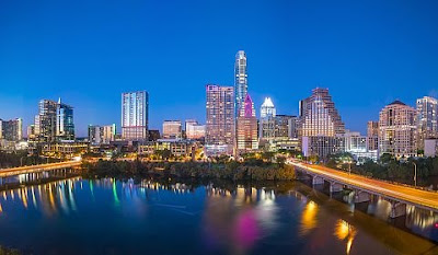
The skyline of downtown Austin, Texas.

The capital city of Texas is Austin.

Texas is a state in the southern United States, and it is the second-largest state in the country by population and land area. Texas occupies a total area of 268,820 square miles and has a population of 27,862,596 people according to the most recent 2016 census. Austin is the state capital of Texas and serves as the seat of Travis County. The Austin-Round Rock metropolitan area has a total population of 2,056,405, which ranks fourth highest in the state. Texas has previously had many other state capitals prior to Austin.

History of the State Capital of Texas

Texas gained its independence from Mexico in 1836 and became an independent Republic. It became the 28th state of the US, and it has since had many capitals. Prior to independence, state capitals have included Monclova Coahulia, Los Adae, San Antonio, San Felipe de Austin, Harrisburg, New Washington, and Velasco. In 1836, Columbia became the first capital of the elected government of the Republic of Texas. From 1837 to 1839, Houston was named state capital. Since 1839, Austin has served as the capital of Texas.

Austin

The city of Austin was named after Stephen F. Austin, who is also known as the father of Texas. It is the second largest state capital in terms of population, after Phoenix, Arizona. Austin is located in the central part of the state, in the foothills of Texas Hill Country. The city developed due to the many rivers, lakes, and waterways in the region, which include Lake Austin, Ladybird Lake, Lake Marble Falls, Lake Georgetown, Canyon Lake, Devil’s core at Lake Travis, Plugerville Lake, Quarry Lake, and Lake Buchanan. The city is a home to 947,890 people, and is the fastest growing large city in the United States. The city of Austin is home to the headquarters or regional offices of many Fortune 500 companies, including eBay, Cisco, Apple, IBM, Amazon, Google, PayPal, 3M, Oracle Corporation, Intel, Cisco, and Texas Instruments. The global headquarters of Dell is located in the suburbs of Austin.

Cultural Significance of Austin

The city has many museums and cultural centers including George Washington Carver Museum and Cultural Center, which receives millions of visitors every year. Other museums include Henry Museum and Susanna Dickinson Museum which celebrate Texas’s historical heritage by providing educational programs to the citizens of Austin. Austin holds cultural events and festivals almost every month of the year, as the city refers to itself as the Live Music Capital of the World. A great example of this is Austin's annual South by Southwest (SXSW) music 
festival.

Notable Sites in Austin

The city has many famous sites, museums, lakes, and hotels. The University of Texas at Austin is an education center and has beautiful sights and landmarks.

The university includes the Texas Memorial Museum, which has historical monuments and galleries that offers historical education to the students.

•By Joseph Kiprop

•culled from www.worldatlas.com


Biggest Cities In Texas

Dallas, the third largest city in the state of Texas.
Houston, the largest city in Texas, is a global city, and a center for business, international trade, entertainment, and more.

The US state of Texas is one of the largest economies in the US. In fact, if Texas were a sovereign state, it would be the 12th largest economy in the world, ahead of countries like Australia and South Korea in GDP. Texas ranks as the second most populous state in the US with a population of 27,469,114 residents. The State has a wealth of natural resources that includes oil wells, wind power, and solar power.

The Largest Cities In Texas

1. Houston - 2,296,224

Houston ranks number one among the biggest cities in Texas. It has an estimated population of 2 million residents. The city has residents of diverse ethnic and religious backgrounds. Houston is the most diverse city in Texas, and it is home to Space Center Houston- NASA’s official visitor center and an attraction for many tourists. The Space Center offers space crafts and simulators training. Houston is known for its thriving visual and performing arts scene. It accommodates the Houston Grand Opera, Houston Ballet, and Houston Symphony Orchestra.

2. San Antonio - 1,469,845

San Antonio, the second biggest city in the state, has an estimated population of 1.4 million residents. The Alamo- a Spanish Mission center established in the 18th Century and later converted into a fortress- is the city’s main attraction. The Alamo is part of the San Antonio Missions National Park; the only world heritage site in the state of Texas. Riverwalk, which is a series of walkways along the banks of San Antonio River, is another popular attraction in San Antonio. Riverwalk is lined with bars, restaurants, and shops. Other popular sites in San Antonio include Tower of Americas, Marriage Island, and Sea world.

3. Dallas - 1,300,092

Dallas is the third largest city in Texas and the ninth largest city in the United States. Dallas is located in north Texas, and is unique among major cities for not having access to the sea. The population of Dallas is growing at a rate that is higher than other cities in the United States - in fact, it is one of the country's fastest growing metropolitan areas.

4. Austin - 931,820

Austin is the fourth largest city in Texas, with just under one million residents. It also has the designation of being the capital city of Texas. Like Dallas, Austin's population is growing quickly. Due to the presence of several live music venues and a few major music festivals, Austin has the nickname of the "Live Music Capital of the World".

5. Fort Worth - 833,319

Forth Worth, which is part of the Dallas-Forth Worth Metropolitan area, is also the fifth largest city in Texas in its own right. Fort Worth is well known for being the epicenter of cowboy culture. Fort Worth is also home to a number of universities and colleges.

Biggest Cities In Texas

Rank Texas City Population

1 Houston 2,296,224
2 San Antonio 1,469,845
3 Dallas 1,300,092
4 Austin 931,820
5 Fort Worth 833,319
6 El Paso 681,124
7 Arlington 388,125
8 Corpus Christ i324,074
9 Plano 283,558
10 Laredo 255,473
11 Lubbock 249,042
12 Garland 236,897
13 Irving 236,607
14 Amarillo 198,645
15 Grand Prairie 187,809
16 Brownsvillen183,887
17 McKinney 162,898
18 Frisco 154,407
19 Pasadena 153,784
20 Mesquite 144,788

•Benjamin Elisha Sawe

•culled from www.worldatlas.com


Monday, 4 May 2020

What Is the Capital of Tennessee?

The skyline of Nashville, Tennessee.
The capital city of Tennessee is Nashville.

Nashville is the capital city of the state of Tennessee. It is popularly known for its music and it has a legendary music house known as the Grand Ole Opry House. Nashville has continued to advance in technology to become the urban centre it is today.

History Of The Capital City Of Tennessee

Before Nashville became the capital of Tennessee, there were two other cities battling it for the position. The two cities were Knoxville and Murfreesboro. On February 6th, 1796 the constitutional convention declared Knoxville as the capital. However, in 1812 through to 1816 Nashville was back as the capital. In 1817 Knoxville was back as the capital once again. In 1818-1826 Murfreesboro was now declared as the capital. A second constitutional convention held in 1826 that put Nashville back as its capital. At 1843 Nashville and Murfreesboro battled again to be the capital of Tennessee. The democrats supported Murfreesboro while the Whigs supported Nashville. Nashville however won as it had better roads and better water connections. The legislature also argued that since the state prison was in Nashville it was suitable to be the state capital as they needed to watch over the prison. Therefore, from 1826 Nashville became the state capital of Tennessee. Nashville has further grown to become the modern urban centre.

Geography Of The Capital Of Tennessee

Nashville is located in middle of the state of Tennessee on the Cumberland valley. It is approximately 526 square miles, and 504 square miles consists of land mass while 22 square miles consist of its water mass. The city has an elevation of 550 feet above sea level. It is the second city in the US to have a land mass of more than 500 square miles.

Population Of Nashville

The population of the capital city of Tennessee is 684,410 which is made up of a highly diverse population. The population consists of white Americans who make 66.99% of the total population, black Americans make up 25.92% of the population, Native Americans 2.23%, Asians 0.07%, and the other races make of the remaining 4.4%.

Economy Of Nashville

Nashville is known for its great music and for producing highly talented musicians such as Johny Cash. This is how it has earned its nickname of music city. The Music Industry contributes about $9.65billion of the economy annually. Nashville is also known for its healthcare companies such as the public traded HCA and community health systems that contribute one billion dollars to the economy. The tourism industry also plays a large part in contributing to Nashville's economy. Having the music convention centre and the music hall of fame, many people are attracted to visiting Nashville to have glimpse of the beauty the city has to offer.

Governance Of The Capital Of Tennessee

Nashville is headed by a mayor who is elected by the people of Nashville. The mayor is only supposed to hold office for a maximum term of eight years. Although there have been attempts to lengthen the period the mayor can be in office, but none of the candidates have been able to collect enough valid signatures to put in the ballot in order for the ruling terms to be amended.

•By Joseph Kiprop

•culled from www.worldatlas.com

Sunday, 3 May 2020

The 10 Biggest Cities In Tennessee

Memphis, the second largest city in Tennessee.
Nashville is the capital and largest city in the US state of Tennessee.

State of Tennessee

Tennessee is a US state located in the country’s southeastern region. It encompasses an area of 109,247 square km, making it the country’s 36th most extensive state. With a population of approximately 6,715,984, it is the 16th most populous US state. Tennessee is subdivided into 95 counties and contains 346 municipalities, which are designated as cities or towns. Just over 56% of the state’s population resides in these municipalities.

The Five Most Populated Cities in Tennessee

1. Nashville

Nashville is the most populous city in Tennessee and the 24th largest in the the country. The city, which is also the state capital, had an estimated population of 667,560 in 2017. It is located along the Cumberland River and serves as the county seat of Davidson County. The city was founded in 1779 and named after Francis Nash, a general of the Continental Army during the American Revolutionary War. Today, Nashville is a hub for music, publishing, healthcare, transportation, banking, and education within the state. Several institutions of higher education, including Tennessee State University, Vanderbilt University, and Belmont University, are located in Nashville.

2. Memphis

With a population of 652,236, Memphis is the second most populous city in Tennessee, and ranks as the 25th largest in the country. Memphis is located along the Mississippi River, in the southwestern part of Shelby County, where it serves as the county seat. Historically, the city played a significant role in the American civil rights movement. For example, the assassination of Dr. Martin Luther King, Jr occurred in Memphis in 1968. Today, the city is a center for education, art, entertainment, commerce, and media. FedEx is the largest employer in the city, and the Memphis International Airport is the world’s second busiest cargo airport. Memphis barbecue has become world renowned, and the city hosts an annual World Championship Barbecue Cooking Contest, which is the largest pork barbecue contest in the world and attracts thousands of visitors.

3. Knoxville

Knoxville has a population of 186,239 and is Tennessee’s third largest city. It also serves as the county seat of Knox County. The city, which was first settled in 1786, was the state’s first capital. Knoxville is one of the gateways to the Great Smoky Mountains National Park. The headquarters of several regional and national corporate companies are located within the city. Knoxville is also home to the main campus of the University of Tennessee.

4. Chattanooga

Chattanooga is the fourth most populous city of Tennessee, with a population of 177,571. The city is located in Hamilton County, within southeastern Tennessee, and is situated along the Tennessee River. Chattanooga is a transit hub and is served by numerous highways and railroads. Surrounded by ridges and mountains, the city offers a number of outdoor activities to residents and visitors. In fact, the Chattanooga has been nicknamed "Scenic City." American bandleader and composer Glenn Miller’s song "Chattanooga Choo Choo" has made the city known around the world.

5. Clarksville

With a population of approximately 150,287, Clarksville is Tennessee’s fifth biggest city. It also serves as the county seat of Montgomery County. Clarksville was established in 1785 and later incorporated in 1807. Austin Peay State University is based in Clarksville.

Legal Requirements to Be a Tennessee Municipality

Although some municipalities in the state are referred to as "cities" while others are called "towns," the terms do not have any legal significance in the state. Municipalities with at least 1,500 residents are required to incorporate, either under the city manager-commission or the mayor-alderman charters. At least 5,000 residents are needed for a city to form under a modified city manager-council charter.

The 10 Biggest Cities in Tennessee by Population

Rank City County Population

1 Nashville Davidson 667,560
2 Memphis Shelby 652,236
3 Knoxville Knox 186,239
4 Chattanooga Hamilton 177,571
5 Clarksville Montgomery 150,287
6 Murfreesboro Rutherford 131,947
7 Franklin Williamson 74,794
8 Jackson Madison 67,005
9 Johnson City Washington 66,677
10 Bartlett Shelby 58,622

By Oishimaya Sen Nag

Culled from www.worldatlas.com

Friday, 1 May 2020

What Is the Capital of North Dakota?

The state flag of North Dakota.
The capital city of North Dakota is Bismarck.

Bismarck is North Dakota's state capital. Bismarck ranks second among North Dakota's cities behind Fargo in terms of population. The 2016 population was approximately 72,417 with a metropolitan population of 131,635.

When Did Bismarck Become the Capital?

Bismarck was originally occupied by the Mandan Native American community, who spoke the Hidatsa language. European Americans established a settlement in what was then the Missouri Crossing in 1872, which was later called Edwinton, in honor of Edwin Ferry Johnson, the engineer-in-chief contracted by the Northern Pacific Railway. The company's railroad developments attracted settlers and workers, and the company named the growing city Bismarck in 1872, after Otto von Bismarck, the chancellor of Germany. The name was intended to attract German investment and settlers. Gold deposits in the Black Hills of South Dakota triggered the immigration of thousands of miners to the city. Bismarck was recognized as the capital of Dakota Territory in 1883, and in 1889 it became the capital of the newly incorporated state of North Dakota.

Demographics of Bismarck

The 2010 census reported 61,272 people in the city of Bismarck, which included 27,263 households, and a total of 15,624 families. The population density was 1,986.1 people per square mile. 92.4% of Bismarck's population was Caucasian, 0.7% was African-American, and Native Americans and Asians made up 0.6% and 0.3% of the population, respectively. 1.3% of the residents identified as either Latino or Hispanic of no particular race. Bismarck's median age was 38 years, while the gender makeup was 51.4% female and 48.6 male. The city's average family size was reported to be 2.82, and the average household size was 2.18.

Economy of Bismarck

The health sector is a major employer in the capital city of Bismarck. Sanford Health has 25,000 employees in the company, while St. Alexius Medical Center employs 2,264 individuals. The state of North Dakota employs about 4,400 workers, and 1,200 individuals work for the federal government. Other top employers are the public schools, Wal-Mart, the City of Bismarck, Coventry Health Care, MDU Resources, and Aetna.

Government of Bismarck

Bismarck is governed by the city commission type of municipal government. Citizens choose five at-large city commissioners who must receive the majority of electorate votes. This scenario makes it difficult for minorities and other interest groups to propel the candidates they prefer to victory. The city's mayoral position is occupied by the city commission's president. The city commission convenes on the second and fourth Tuesday of every month. Bismarck is home to North Dakota's state capitol building, which houses the legislative and judicial divisions of the state, in addition to multiple government agencies.

Transportation in Bismarck

Bismarck has a public bus system which commenced operations in May 2004. The system maintains eleven routes across Bismarck and Mandan. The Bismarck Municipal Airport lies south of the city, and is served by airlines such as Delta Air Lines, Frontier Airlines, and United Express. The airport handles the second highest passenger volume in North Dakota and the highest in western North Dakota. The city is further served by the BNSF Railway and two federal highways.

•By Benjamin Elisha Sawe

•culled from www.worldatlas.com


The 10 Biggest Cities In South Dakota

Sioux Falls is one of the fastest growing
cities in the US.
Sioux Falls is the most populated city in the US state of South Dakota.

The US state of South Dakota is located in the country’s Midwestern region. It has a population of approximately 869,666, making South Dakota the 5th least populous state in the country. With an area of 199,729 square km, it is the 17th most extensive US state. Additionally, South Dakota is the 5th least densely populated state in the country. Sioux Falls is the largest city in the state, followed by Rapid City, Abrdeen, Brookings, and Watertown.

The Five Biggest Cities in South Dakota

1. Sioux Falls

Located in the extreme eastern part of the state, Sioux Falls is South Dakota’s biggest city. It had a population of 153,888 individuals in 2010, which ranks as the 143rd most populous city in the country. Sioux Falls serves as the county seat of Minnehaha County, but also extends into Lincoln County. The city is one of the 50 fastest growing cities in the US and experienced a population growth of 22% between 2000 and 2010. The economy of Sioux Falls was initially centered on agriculture-based industries and quarrying. Today, the city has a diversified economy, which includes thriving healthcare, financial services, and retail trade industries.

2. Rapid City

South Dakota’s second biggest city, Rapid City, had a 2010 population of 67,956 in 2010. It also serves as the county seat of Pennington County. The city is located on the eastern slope of the Black Hills mountain range, near Rapid Creek, which is a tributary of the Cheyenne River. Given its proximity to the Black Hills, the city has been nicknamed the "Gateway to the Black Hills." Additionally, Rapid City is also referred to as the "City of Presidents" due to the life-size bronze statues of US presidents located in the city's downtown area. A number of tourist attractions are located near Rapid City, within the Black Hills, such as Mount Rushmore, Custer State Park, and Wind Cave National Park.

3. Aberdeen

With a population of 26,091, Aberdeen is South Dakota’s third most populous city. It is also the county seat of Brown County. Aberdeen is regarded as a college town, given that Presentation College and Northern State University, two prestigious academic institutions within the state, are located in the city.

4. Brookings

Brookings is South Dakota’s fourth-largest city, with a population of 22,056 in 2010. The city also serves as the county seat of Brookings County. The state’s largest institution for higher education, South Dakota State University, is based in Brookings, as well as the South Dakota Art Museum. Several manufacturing and agricultural corporations have headquarters in the city.

5. Watertown

Watertown is South Dakota’s fifth most populous city, as well as the county seat of Codington County. In 2010, the city had a population of 21,482. The Redlin Art Center is located in Watertown, which contains many original works of art by Terry Redlin, one of the country’s most renowned wildlife artists.

The Capital of South Dakota

With a population of only 13,646, Pierre is the state capital of South Dakota. It is the eighth largest city in the state and serves as the county seat of Hughes County. Pierre is the country’s second least populated state capital, after Montpelier, Vermont.

The 10 Biggest Cities in South Dakota by Population

Rank City Population (2010 Census) County

1 Sioux Falls 153,888 Minnehaha, Lincoln
2 Rapid City 67,956 Pennington
3 Aberdeen 26,091 Brown
4 Brookings 22,056 Brookings
5 Watertown 21,482 Codington
6 Mitchell 15,254 Davison
7 Yankton 14,454 Yankton
8 Pierre 13,646 Hughes
9 Huron 12,592 Beadle
10 Vermillion 10,571 Clay

•By Oishimaya Sen Nag

•culled from www.worldatlas.com


Related Posts Plugin for WordPress, Blogger...